Lukla, donkeys with bells, prayer flags, and downhill treks—Days 1–4 of EBC tested my knees and my nerves. Curious how I survived? Read my blog!
Disclaimer: All views expressed on this blog are my own based on my own experiences and do not represent of any entity with which I have been, are now or will be affiliated
May 15,2025
Batangas, Philippines
Hike Dates: April 6–19
April 18: Flight from Lukla to Kathmandu
April 19: Rest day in Kathmandu
Part 1: Hiking Overview here
Nepal Travel Guide here
Table of Contents
1. Comprehensive Itinerary for the Everest Base Camp Trek from Day1-4
April 6 (Sunday) – Day 1: Drive to Ramechhap Airport and Flight to Lukla
We woke up at 12:30 AM for the early morning drive to Ramechhap Airport, where we would catch our flight to Lukla, the starting point of our Everest Base Camp adventure.
By 1:15 AM, we were on the road, leaving our hotel in Thamel (Hotel Kailash Kutee) in a private, air-conditioned van, bags in tow. I had left my main luggage at the hotel in Thamel and packed only what was necessary for the trek. We were given snack boxes, which included an apple, bread and egg, a banana, and juice, to keep us fueled for the journey.
The ride to Ramechhap Airport was nothing short of a crazy adventure. The road was bumpy, winding, and in rough condition due to ongoing construction from the aftermath of floods and earthquakes in the area. The bumps were relentless, and sleep was a challenge. I remember banging my head against the van each time the road became particularly rough when I fell asleep, but I eventually gave up on trying to sleep, deciding it was more important to rest my body whenever I could. The whole journey took 5-6 hours, so it’s crucial to leave early to make sure you arrive at the airport in time.
Information on Ramecchap Airport –
Since 2019, trekking teams and adventurers have had to adjust their plans due to a major change in Nepal’s air travel logistics. The Government of Nepal and the Civil Aviation Authority of Nepal (CAAN) announced that, due to construction and improvements at Kathmandu Tribhuvan International Airport, flights to and from Lukla would be redirected to Ramechhap, Manthali Airport.
Initially, this change raised some concerns, but it has actually turned out to be a positive shift. With the reduction in air traffic at Kathmandu, delays and backlogs have decreased, making travel smoother for everyone. Ramechhap, now dedicated solely to Lukla flights, has been able to better manage and increase its flight capacity, which has become a regular practice each trekking season. This adjustment has ultimately made the journey to Lukla more efficient, even if it means a longer drive to the alternative airport.
Arrival at Ramechhap Airport
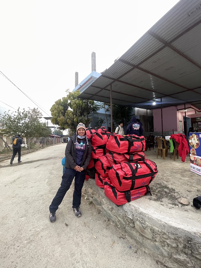
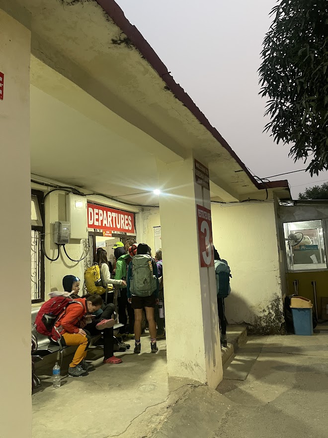
We arrived at Ramechhap Airport around 6:00 AM and began unloading our bags from the van. A helpful tip: make sure to attach a 1×1 or 2×2 photo to your duffle bag — it makes identifying your luggage much easier.
After unloading, we waited for our guide, Nitesh, who assisted us with securing our boarding passes for the flight to Lukla. While we waited, we rested at one of the small cafés outside the airport. I managed to squeeze in nearly an hour of sleep — the long, bumpy ride really wore me out, and we still had some time before we were called to weigh our bags.
The airport was crowded with trekkers, as flights to Lukla had been delayed for two days, causing a significant backlog of passengers. The space itself was quite small, which made it feel even more packed. The process began with having our bags weighed, after which we had to wait again until our boarding was called.
After hours of waiting, we were finally allowed to enter the airport, go through security, and check in our bags. In our rush to meet our guide’s instructions to head to security, I didn’t have time to wait for my order at the nearby cafeteria — and ended up eating someone else’s food! Thankfully, I was able to reimburse the meal. But the adventure didn’t stop there. We continued waiting until 2:00 PM, only to find out that our flight had been delayed — and eventually canceled. Our only option was to try again the next day.
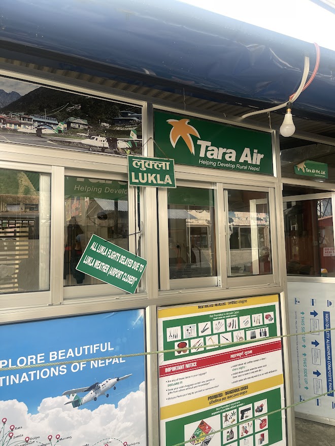
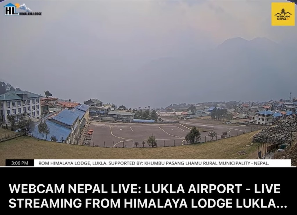
Delays like this are quite common, so it’s important to be mentally prepared. For those who are short on time (and have the budget), there’s the option to take a helicopter to Lukla. It costs around USD 2,500, but the price can be split among up to five passengers, depending on the helicopter’s capacity. You can also check their YouTube channel for live updates here from Lukla Airport to see if there’s a chance your flight might depart the following day.
Due to the delay, we left our duffle bags at the airport and only took the essentials with us, ensuring we had everything needed for a comfortable night at our homestay.
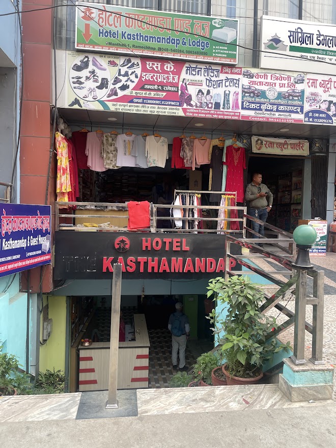
Hotel Kasthmandhap
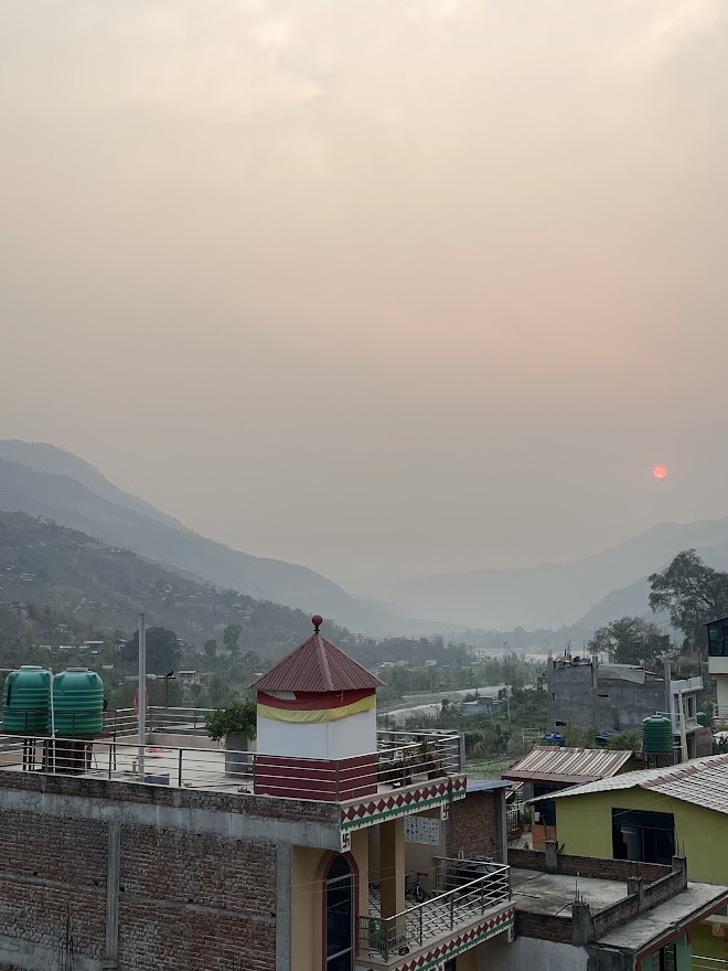
We stayed at a homestay that provided outlets for charging and a private bathroom with a hot shower. The cost for a one-night stay was 2,000 PHP, and I shared the room with Aya who also happened to be my roommate at all the other homestays during the Everest Base Camp Expedition. The roommate assignment is handled by the organizer (I’m not sure how they select, but it’s probably random). The room was decent for a one-night stay, and I slept comfortably. The only issue for me was the pillow, which was quite hard, but otherwise, everything was fine.
The food here was decent, with meals ranging from 150-200 PHP. There weren’t many options at the nearby stores, so we ended up ordering everything from the homestay. The wifi connection was also reliable. This place gave me a similar vibe to Benguet on our way to the mountains there — the homestays and overall atmosphere felt quite familiar.
April 7 (Monday) – Day 2: Second Attempt to Fly to Lukla and Trek to Phakding
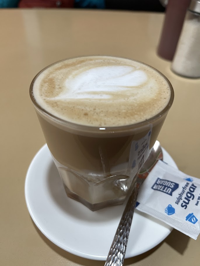
We woke up around 4:30 in the morning and had our breakfast coffee in the homestay. When everything is settled, we left around 5:15am via tuktuk going to Ramecchap airport for our second attempt to fly to Lukla.
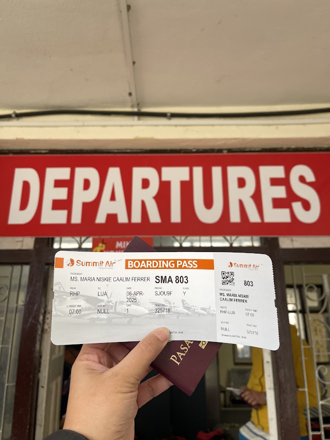
Upon arriving at the airport, we had to weigh our carry-on bags again and go through security checks. We were also issued new boarding passes for today’s flight.
Thankfully, we were already in the next queue due to our flight delay the previous day. Honestly, I don’t think I could’ve managed this trip without the help of a guide — the airport experience can get pretty chaotic.
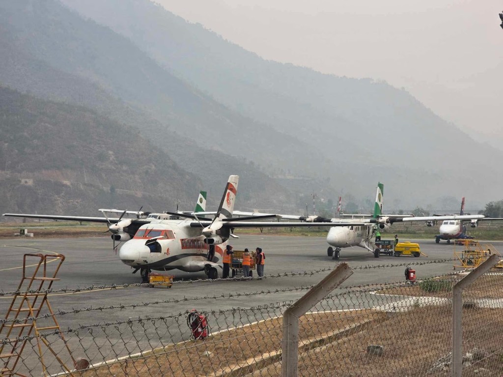
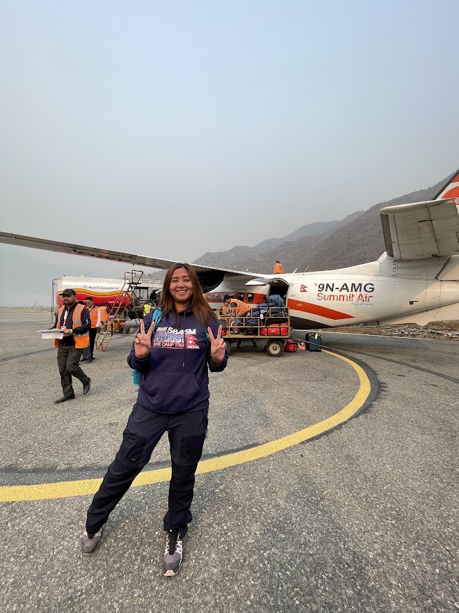
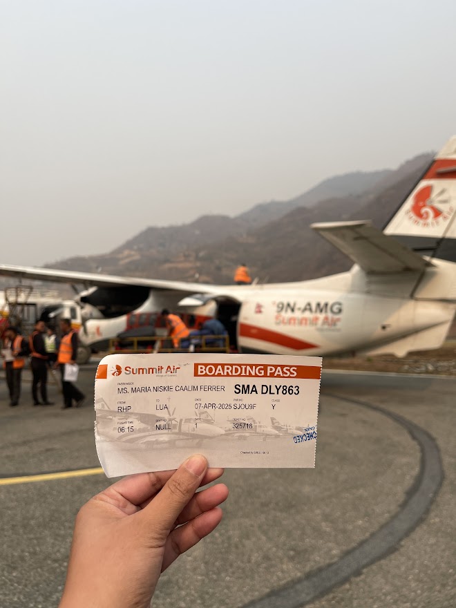
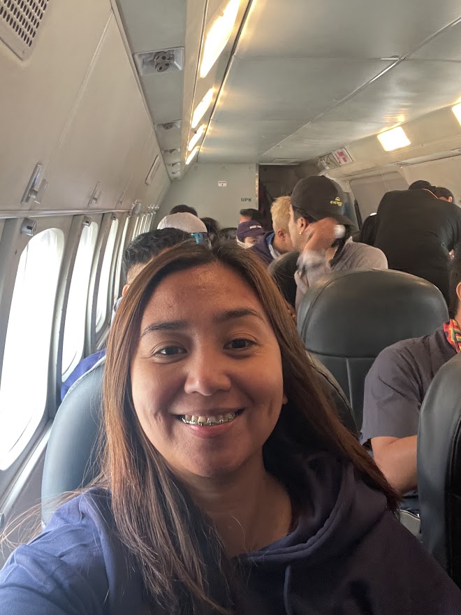
At last, around 8:12 AM, we were cleared to board our flight. We flew with Summit Air, a two-propeller plane that holds up to 18 passengers. The Lukla flight has a strict weight limit of 15kg, which includes 10kg for checked luggage and 5kg for hand-carry items. I was pleasantly surprised to find that the flight even had a stewardess. The journey from Ramecchap to Lukla takes about 20-30 minutes.
Tenzing Hillary Airport – Lukla
Tenzing Hillary Airport is the primary gateway for treks to the Everest region located in Lukla. Flights to Lukla operate year-round, with peak seasons occurring between March and May, and September through November. Construction of Lukla Airport began in 1963 under the direction of Sir Edmund Hillary and was completed in 1974, taking nearly a decade to finish.
The airport is famously known as one of the most dangerous in the world. The airport’s dangerous reputation stems from its high altitude, short runway, surrounding mountainous terrain, and the thin air, making landings and takeoffs particularly challenging.
I was beyond thrilled to finally land at Tenzing Hillary Airport. First, it was an adventure in itself to land at the world’s most dangerous airport, and second, it marked the beginning of our long-awaited expedition.
Please be aware that taking videos during the landing at the airport is prohibited for safety reasons.
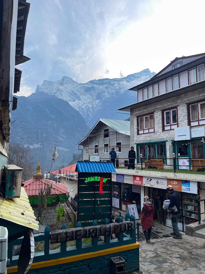
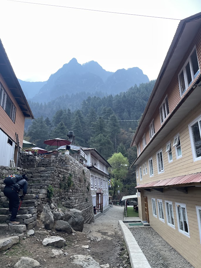
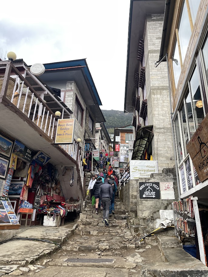
Lukla
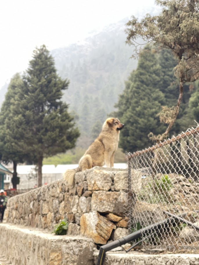
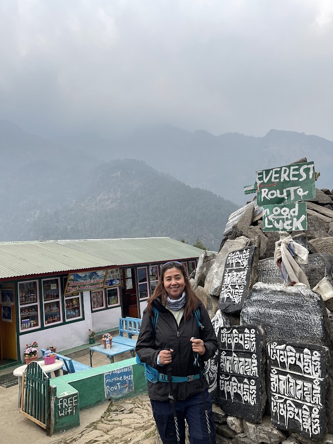
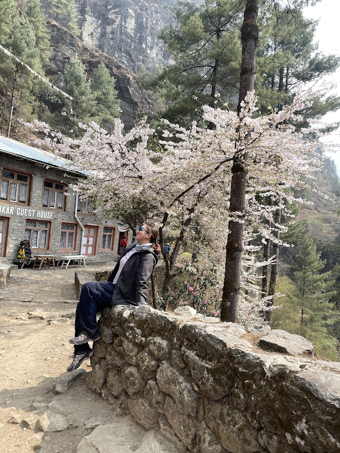
Lukla is the gateway to the Everest region, located in the Khumbu area. This village is home to the region’s main airport, making it the primary entry and exit point for most travelers heading to Everest. Situated at an altitude of 2,860 meters above sea level, Lukla is lined with hostels and cafes. I really enjoyed this place, but I’ll share more about it on our final day.
Hotel The Nest Lukla
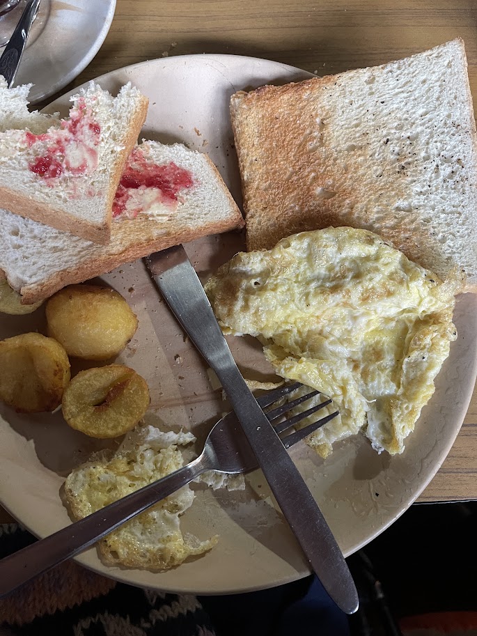
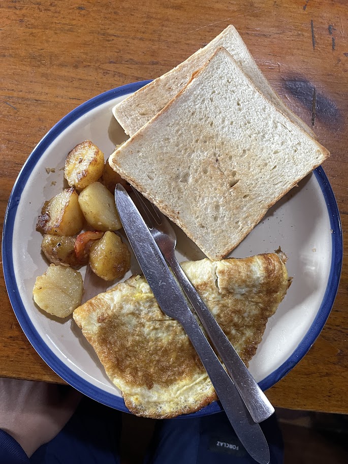
After arriving and collecting our bags, we made our way to Hotel Nest Lukla for breakfast. I opted for the American breakfast (2 slice of bread, scrambled eggs, butter and potatoes) and took some time to relax and rest. The restaurant is decent as well with a lot of chairs and tables to choose from.
Trek to Phakding
Starting Elevation: 2,860 m / 9,383 ft
Ending Elevation: 2,610 m / 8,563 ft
Hiking Time: 5 hours (my pace)
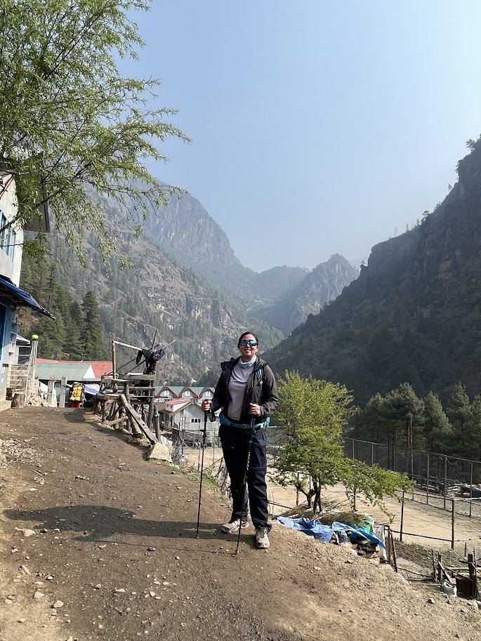
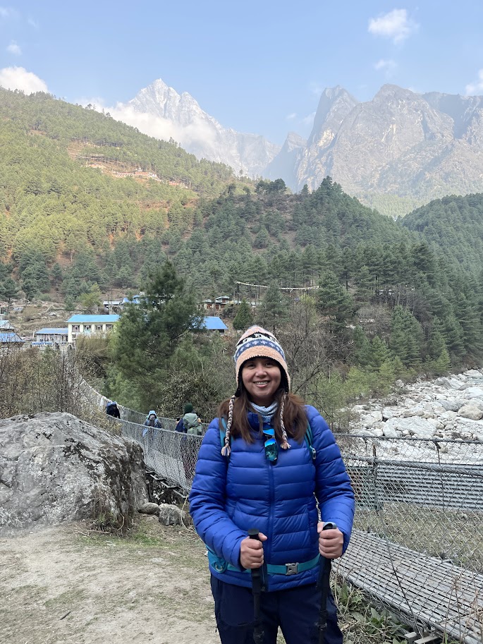
After breakfast, we began our trek to the first village on our route — Phakding. Luckily, the spring weather was perfect for hiking, around 19°C, which made the journey comfortable and enjoyable. The distance from Lukla to Phakding is roughly 7.5 to 8 kilometers. Although the average trek time is about 3 hours, it took me around 4 hours at my own pace.
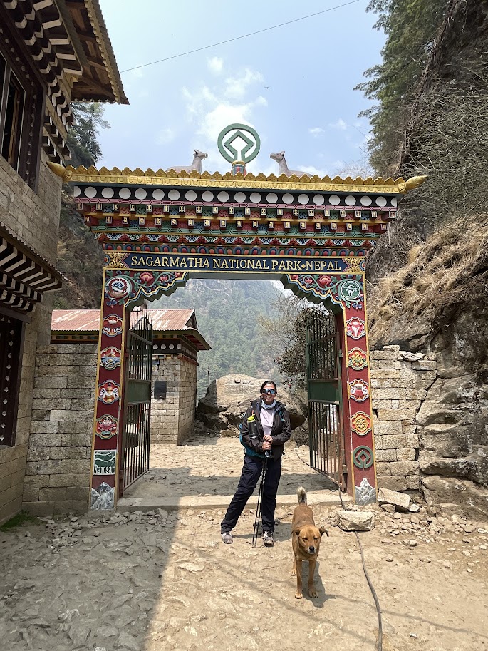
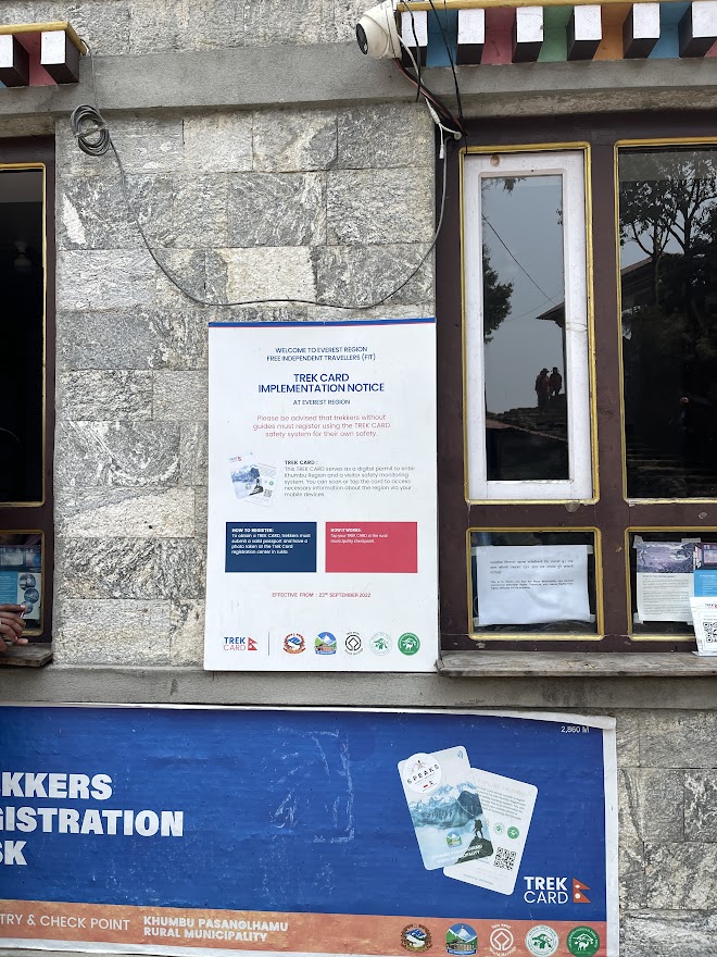
It takes about 10 minutes to pass through Lukla town, where you’ll come across a gate featuring a statue of Pasang Lhamu Sherpa — the first Nepali woman to summit Mount Everest. Just after that, the trail begins to descend, and you’ll reach the Khumbu Pasang Lhamu Rural Municipality checkpoint, where you need to purchase an entry permit for 2,000 NPR or 1,000PHP. Our guide already helped with this, just present your passport to him.
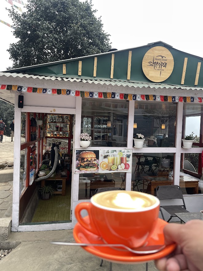
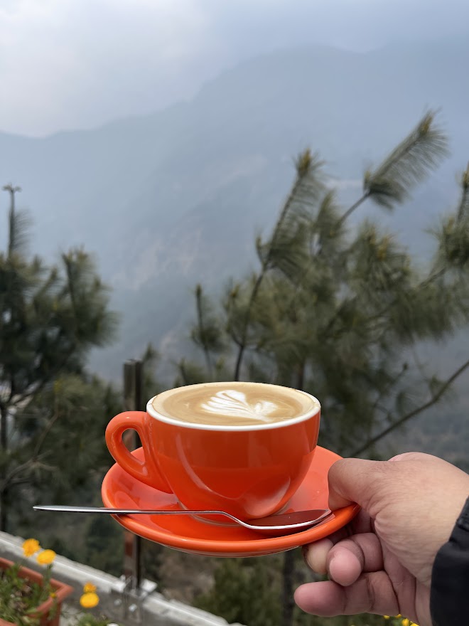
Once we passed the checkpoint, the trail gently descended through a scenic forest of rhododendron, pine, and oak trees, eventually leading us to the village of Chhepulung. After trekking for about an hour and a half, we took a coffee break at Sherpa Café. The café had a charming al fresco setup with views overlooking the mountains. Although the misty weather limited visibility, the atmosphere was serene and cozy. They served authentic Himalayan coffee, and the place also had a washroom available for trekkers.
From Chhepulung, the trail continued with a gradual descent and some flat stretches until we reached Thadokoshi. Along the way, we crossed two suspension bridges and caught glimpses of the Dudhkoshi River flowing through the valley to our left.
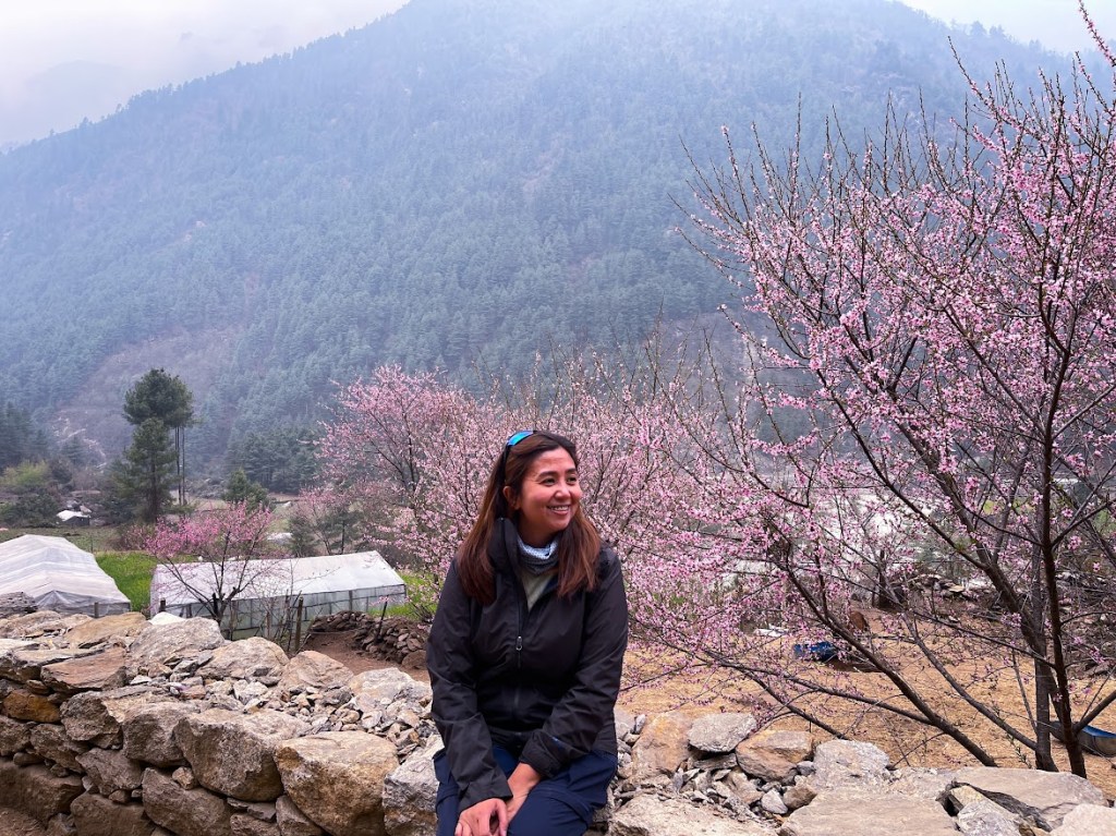
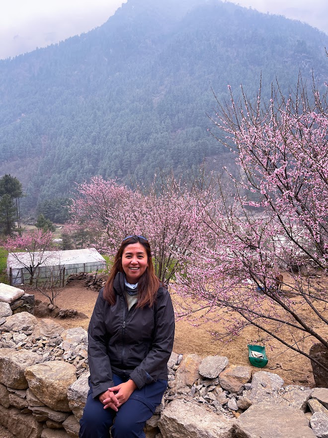
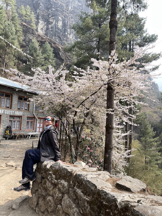
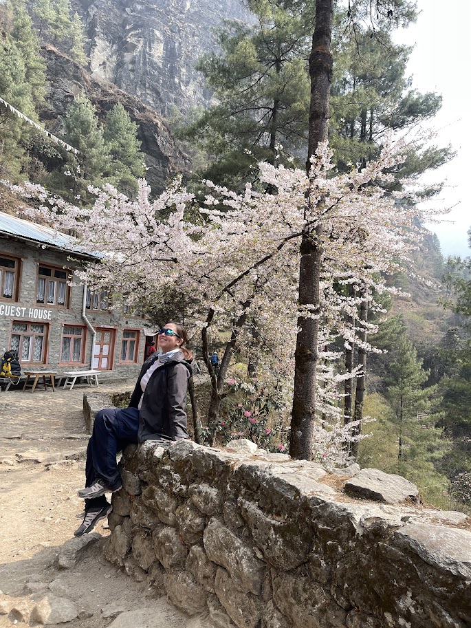
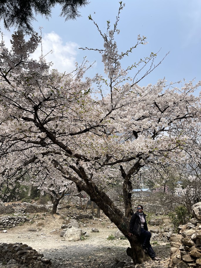
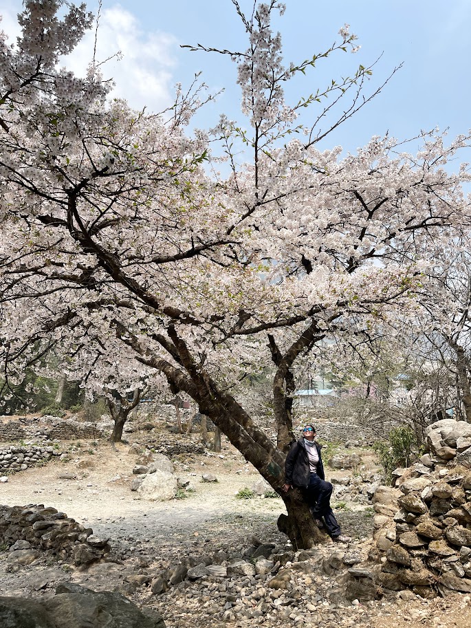
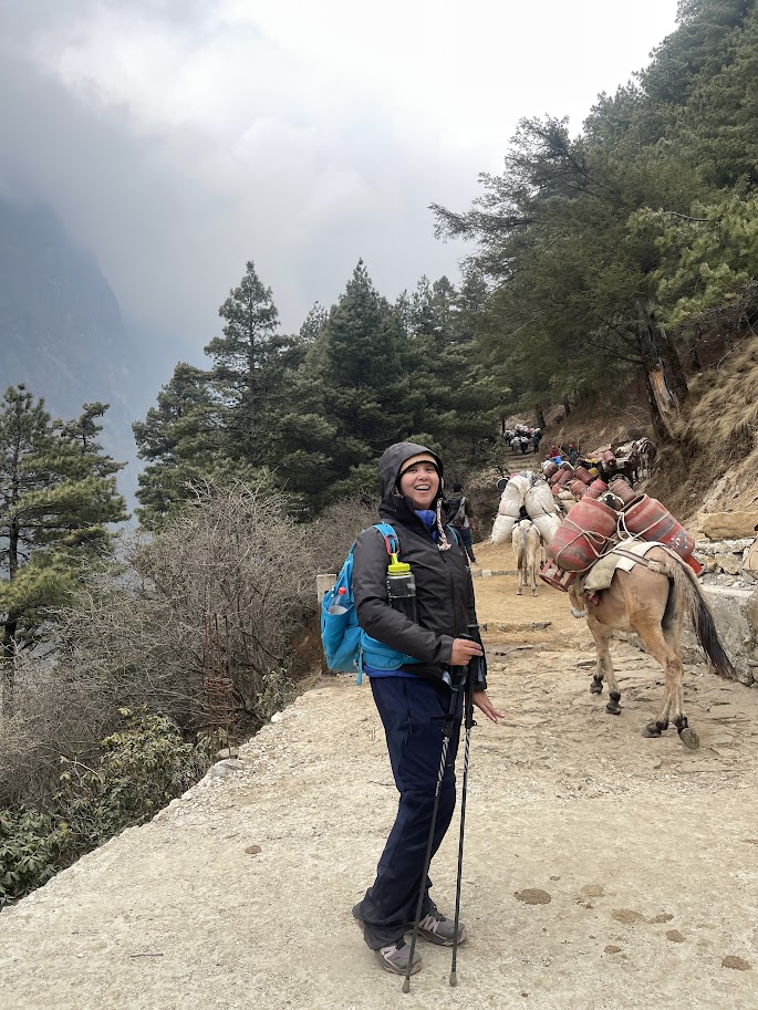
The trail is beautifully adorned with Mani walls, Mani wheels, and Mani stones, along with strings of colorful prayer flags fluttering in the breeze. We even passed vibrant pink flowers that reminded me of cherry blossoms. Along the route, we saw horses carrying heavy loads like LPG tanks, as well as goats and buffaloes hauling supplies — a real glimpse into the daily life in the Himalayas.
Overall, I found the trek to be relatively easy, made even more enjoyable by the stunning scenery along the way.
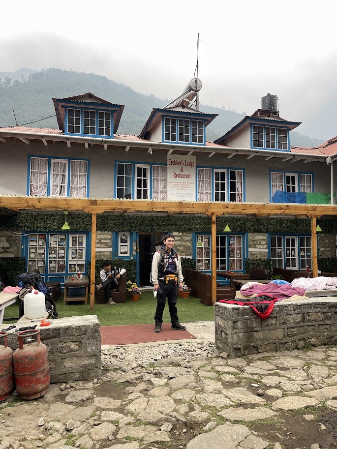
Trekker’s Lodge and Restaurant
After 4 hours and 45 minutes of trekking—made a bit longer thanks to plenty of photo breaks—we finally arrived at our homestay. The place was comfortable and ideal for resting, with a private bathroom, though unfortunately, there was no hot shower available. I had to brave the cold and take a chilly shower, which was quite the experience with the temperature already dropping to 14°C.
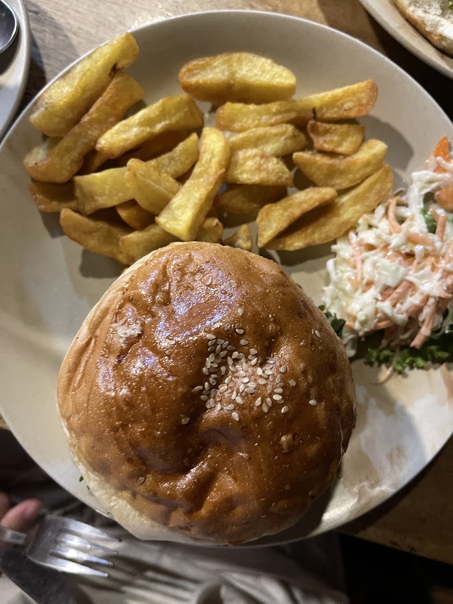
For dinner, I ordered a burger and fries, along with a cup of ginger lemon tea and a Coke. The food was simple but satisfying—just what I needed after a long day on the trail.
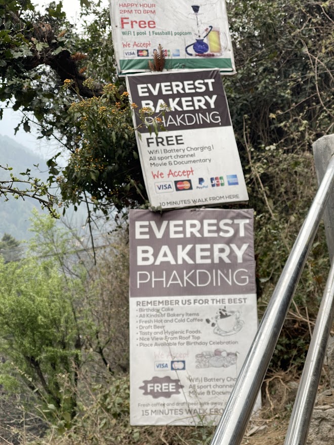
Irish Bar and Everest Bakery
Price: 500PHP-700PHP
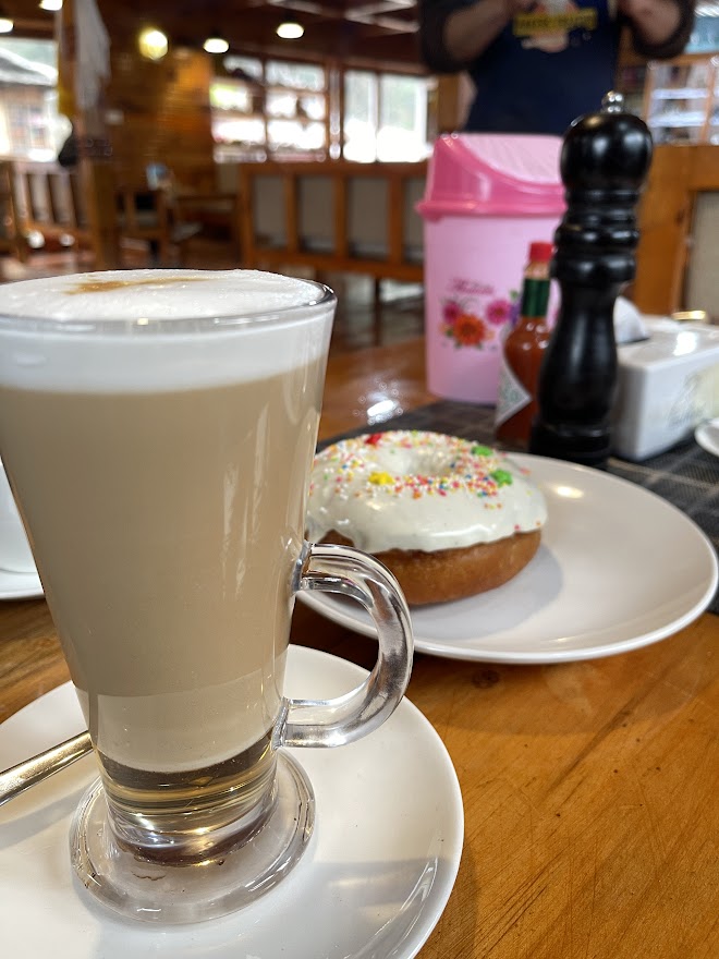
Just a short walk from our homestay was a charming, cozy café that felt incredibly welcoming. I treated myself to donuts and a cup of coffee—a perfect reward after a long day of trekking. I was genuinely surprised by the quality and presence of such lovely cafés in these remote villages, making it a must-try experience for anyone on the trail.
The café featured cozy seating and a laid-back atmosphere, making it an ideal place to unwind after the trek. A reliable Wi-Fi connection was a welcome bonus. I really loved the overall vibe—it was the perfect spot to relax and enjoy the moment. They also had an al fresco dining area, but since the weather was quite cold, we chose to stay inside where it was warmer and more comfortable.
After visiting the cafe, we stopped to buy prayer flags, which we tied in our bags for good luck. Many other hikers also do the same thing.
April 8 (Tuesday) – Day 3: Trek from Phakding to Namche Bazaar
Starting Elevation: 2,610 m / 8,563 ft
Ending Elevation: 3,440 m / 11,290 ft
Temperature: 10°C
Hiking Time: 7 hours (at my own pace)
After enjoying my usual American breakfast—scrambled eggs, potatoes, buttered bread, and a cup of Americano—I got ready for the day. We set off around 7:30 AM, beginning our trek toward Namche Bazaar.
What I didn’t expect was just how challenging this part of the journey would be. So far, this was easily the toughest stretch, both physically and mentally.
We crossed the first suspension bridge after walking around 10–15 minutes from the lodge and still be in the same town.
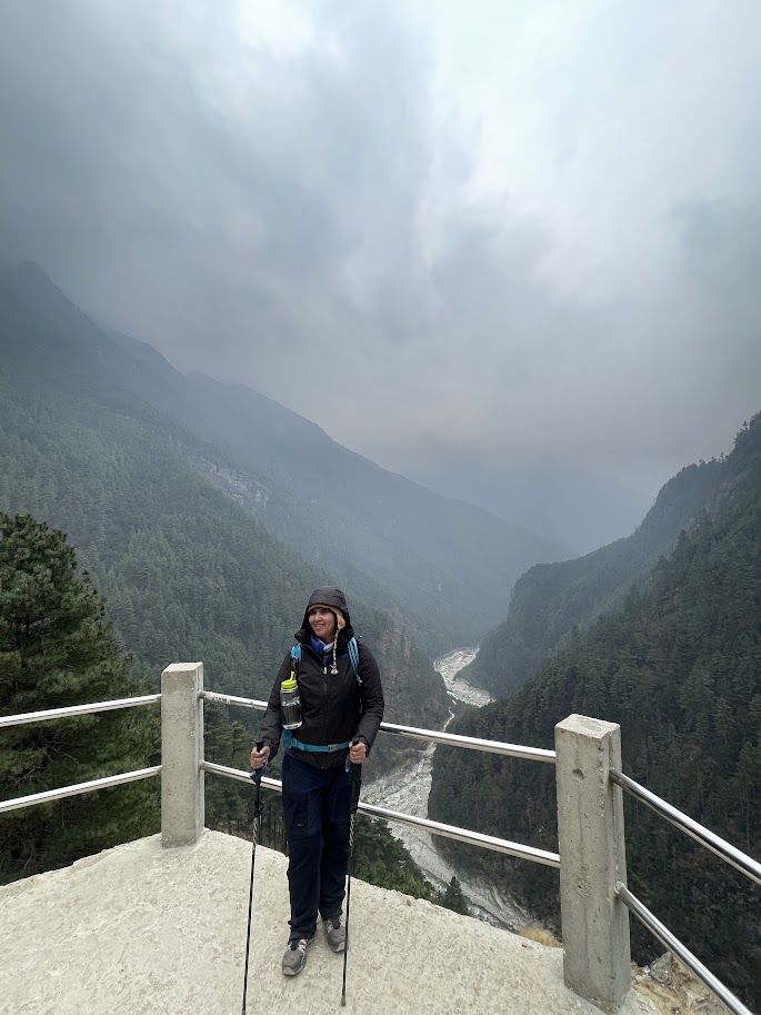
The day felt like an endless series of ascents and descents, each one more exhausting than the last. I didn’t anticipate how challenging this day would be, even though the view of the Dudh Kosi River was nothing short of stunning. We took a few short breaks along the way, soaking in the landscape and allowing ourselves a bit of rest to recharge for the climb ahead.
Everest Sherpa Cafe
After two hours of trekking, we made a quick stop at a cozy café to recharge with some coffee. The café had a relaxed alfresco vibe, perfect for taking a break. It also offered Wi-Fi, though there was an additional charge for its use.
After enjoying a much-needed coffee break, we continued our trek by crossing the river once again, spinning the prayer wheel along the way—a calming ritual that many hikers take part in for blessings and good fortune. We made our way across a series of well-maintained suspension bridges, which, although sturdy, still gave off that slight adrenaline-inducing sense of vulnerability, as if they could sway or give way at any moment.
What truly made this part of the trek memorable was the shared path between people and pack animals. Horses and buffaloes traversed the same narrow bridges, their bells ringing rhythmically with every step. That gentle clinking sound became the unofficial soundtrack of my hike—a soothing and consistent presence that blended seamlessly with the natural ambience of the Himalayas. It was a reminder of how every element on this trail, from humans to animals, coexists in a beautiful and time-honored rhythm.
The bridges themselves were decorated with colorful prayer flags, fluttering in the wind, adding a spiritual touch to the rugged landscape. The water beneath was some of the clearest I’ve ever seen, rushing through the valley with a strength that matched the mountain spirit surrounding us. It felt like the highest river I’ve ever crossed, a powerful reminder of the wild beauty we were trekking through.
My daypack, though only around 3 kg, was starting to take a toll on me during the long trek. The strain was mostly on my right shoulder, and I had to make a quick stop to rest. Thankfully, Ruby—my pace partner—came to the rescue. She helped adjust the straps on my backpack so the weight would be more evenly distributed. We also moved my 1-liter water bottle to the front to help balance the load better. I even poured out some of the water to lighten it further. Small adjustments, but they made a big difference in easing the discomfort.
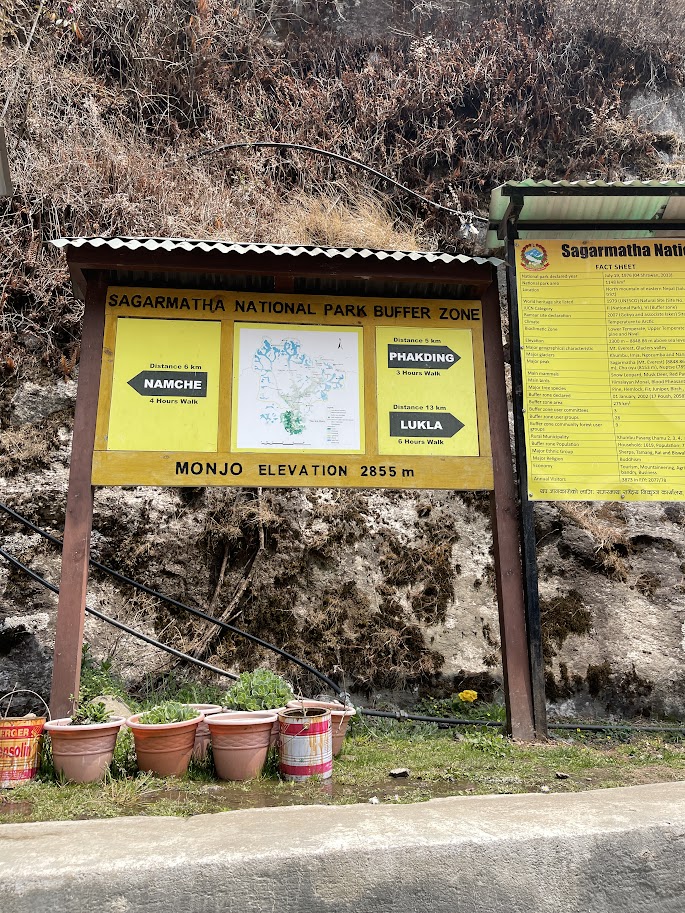
The next village we reached was Monjo, which also marks the official entrance to Sagarmatha National Park—Sagarmatha being the Nepali name for Mount Everest. At this checkpoint, we were required to purchase the TIMS (Trekkers’ Information Management System) card. The cost is 3,000 NPR per person (approximately 1,500 PHP), and this is in addition to the Pasang Lhamu Municipality Entry Permit.
The TIMS card is mandatory for all trekkers in Nepal and plays a crucial role in ensuring trekker safety. In case of an emergency, this card helps authorities locate and assist you. To obtain one, you’ll need to provide health insurance details and a passport-sized photo.
One major advantage of having a guide is that they handle all the paperwork ahead of time, so there’s no need to wait in line or deal with the hassle yourself. We simply collected our passes and smoothly continued through the national park gates.
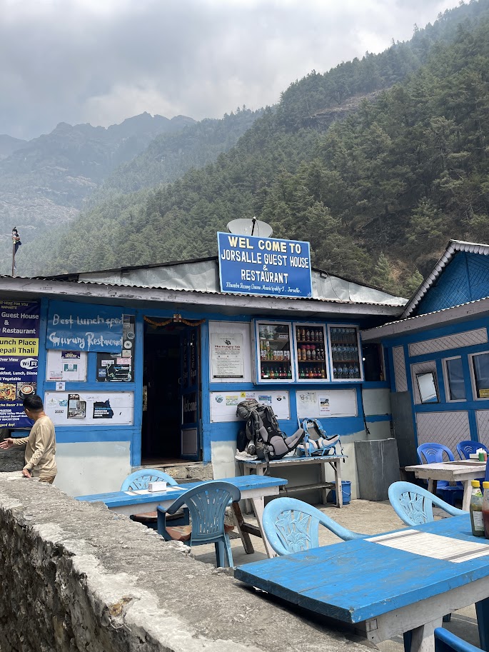
After entering Sagarmatha National Park, the trail leads into a short descent lined with numerous prayer walls and eventually brings you to another suspension bridge. From there, we continued onward until we reached Jorsalle, a small village where we stopped for a much-needed break and lunch.
We dined at a cozy lodge that offered both indoor and al fresco seating, creating a relaxed and welcoming atmosphere for weary trekkers. I can’t quite recall what I ordered—most likely some comforting noodles and a cup of ginger lemon tea to recharge.

As we approached the final suspension bridge leading to Namche, the rain began to fall, adding a moody atmosphere to the already challenging trail. From this point on, the path steepened significantly, making the climb even more demanding.
Just a few meters behind us, a caravan of horses steadily made their way along the trail, transporting gas canisters bound for the guesthouses in Namche Bazaar.
This last and most iconic suspension bridge is known as the Hillary Suspension Bridge, named in honor of Sir Edmund Hillary. It’s the final crossing before reaching Namche and hangs high above the rushing Dudh Koshi River—a glacier-fed river whose name translates to “Milk River” due to its frothy, white waters racing fiercely through the valley below.
All videos on my Youtube channel soon
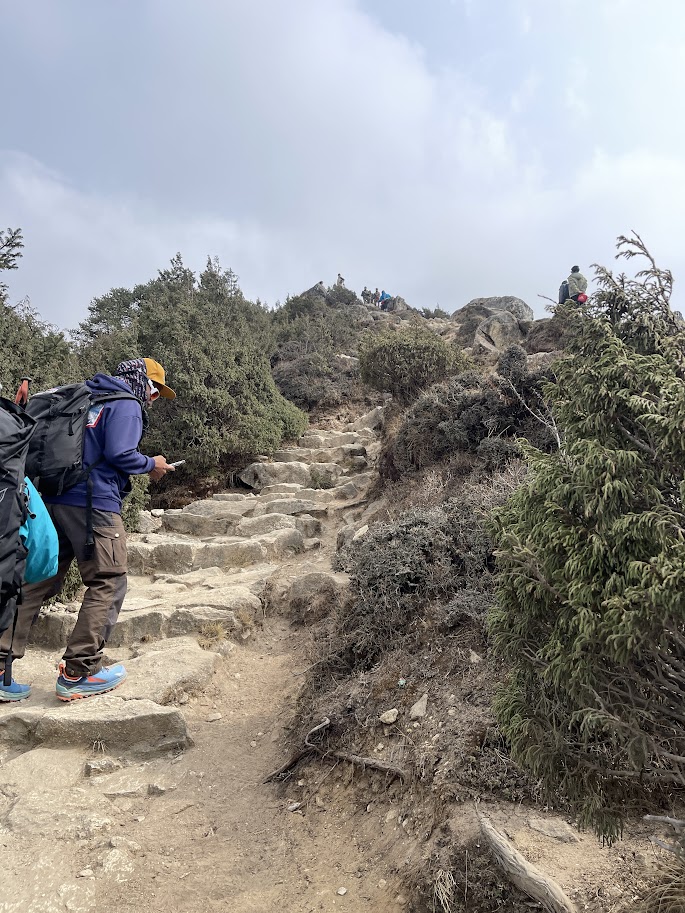
From this point onward, it was a grueling two-hour ascent straight uphill to reach Namche Bazaar. The trail was relentlessly steep, with almost no flat sections to catch your breath. Our pace slowed significantly, and we had to take several short breaks just to regain our energy and composure.
Every step felt heavier as the altitude increased and the terrain became more punishing. This stretch was one of the most physically and mentally challenging parts of the trek so far. I genuinely felt like giving up at some points, completely drained and questioning if I could push any further.
What kept me going was the incredible support from my pace buddy and our Sherpa guide, Lhakpa, who encouraged us with every step. Their presence and motivation were a lifeline through the brutal climb. That steep ascent to Namche will forever be etched in my memory as one of the toughest, most unforgettable parts of this journey.
Just a few meters before finally reaching Namche Bazaar, there was one final checkpoint where our TIMS (Trekkers’ Information Management System) card had to be verified. Thankfully, our guide handled the process smoothly, allowing us to pass through without delay.
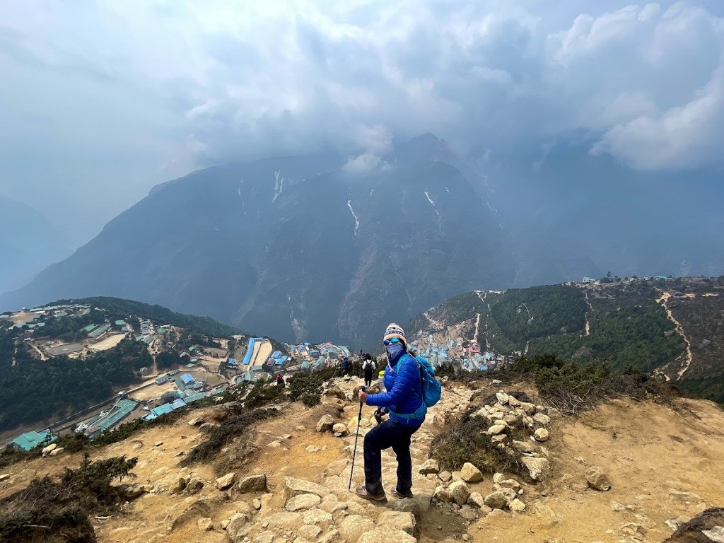
After an intense and exhausting 11-hour trek, we finally arrived in Namche Bazaar at 5:15 PM local time. I was completely worn out—physically and mentally drained from the relentless ascent and the long day on the trail. But the moment we stepped into Namche, all that fatigue seemed to melt away.
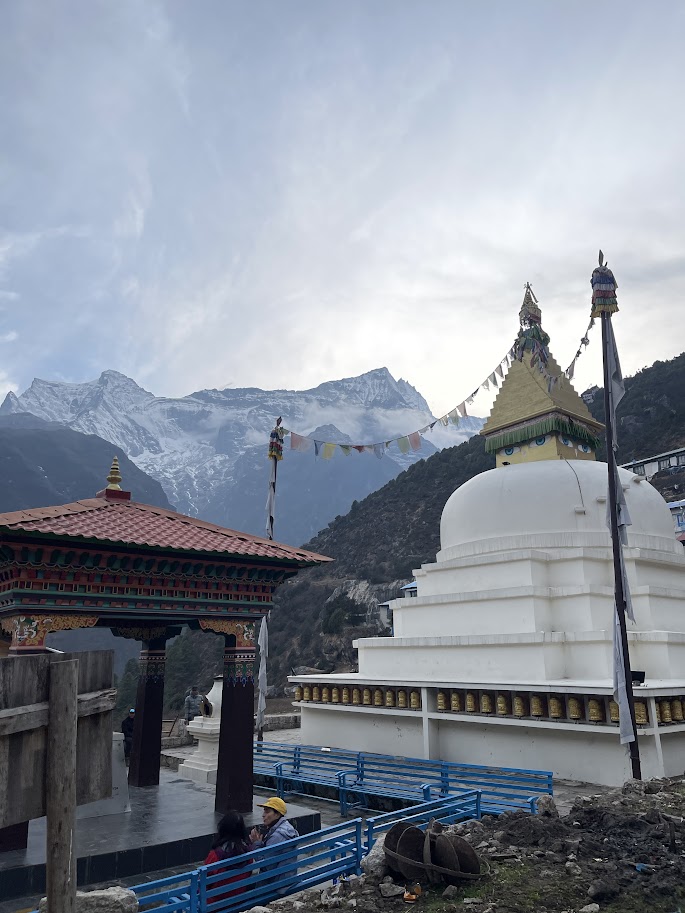
Namche Bazaar
Namche Bazaar, the largest and most vibrant village along the entire Everest Base Camp route, instantly took my breath away. The colorful houses, neatly lined shops, spinning prayer wheels, and intricate stone pathways gave it a charm unlike any place I’ve ever seen. Tucked into the mountainside and framed by the snowy peaks of the Himalayas, Namche felt like stepping into a hidden world—remote yet lively, traditional yet welcoming.
Even in my exhausted state, I couldn’t help but stop and take it all in. The view, the atmosphere, the sheer beauty of it—it was one of those moments where you realize just how special this journey really is. I’m still in awe every time I think back to it.
Bodhi Authentic Sherpa Hospitality
We stayed for two nights at this lodge for acclimitazation, and it quickly became my favorite homestay along the trek. The room was spacious, with a private bathroom, hot showers, and power plugs, which made it incredibly convenient. The bed was comfortable, and the pillows were soft, ensuring a restful night’s sleep. The comforter was cozy, adding to the overall comfort of the room.
The dining area, where we had our meals, was also roomy and inviting, and the staff was exceptionally accommodating. Overall, this place truly stood out, and I really enjoyed my time here.
After dinner, I rested and got ready for the next day.
April 9 (Wednesday) – Day 4: Acclimatization Day – Khumjung Village and Syangboche
Starting Elevation: 11,290 ft / 3,440 m
Ending Elevation: 12,664ft/ 3,860m
Temperature: 8°C
Hiking Time: 4 hours including descent (at my own pace)
When I first received the itinerary from our organizer, Yabag Mountaineering, I was thrilled to see an acclimatization day listed. At first, I thought it would be a relaxed day—perhaps a chance to shop, explore the local area, or visit museums. However, as the expedition progressed, I quickly realized that the acclimatization day wasn’t quite what I had imagined.
Instead of a rest day, it turned out to be another challenging day of hiking, with long hours spent navigating steep ascents. The purpose of the acclimatization day, I learned, was not to take a break but to allow our bodies to adjust to the high altitudes. The goal was to give us time to acclimate and recover, ensuring we were physically prepared for the more demanding hikes as we made our way toward Everest Base Camp. It was a reminder that high-altitude trekking requires both physical endurance and careful planning to help our bodies adapt to the thinner air.
After breakfast, we began our acclimatization hike for the day. Before setting off, our team formed a line, and I was placed at the front with my pace buddy, Ruby. Since this part of the trek involved a steady uphill climb, we took it slow to conserve energy. Even at a slower pace, the steep terrain made the hike quite tiring. One of our teammates, John, unfortunately started feeling the effects of altitude sickness and had to stay back at Bodhi Lodge to rest and recover.
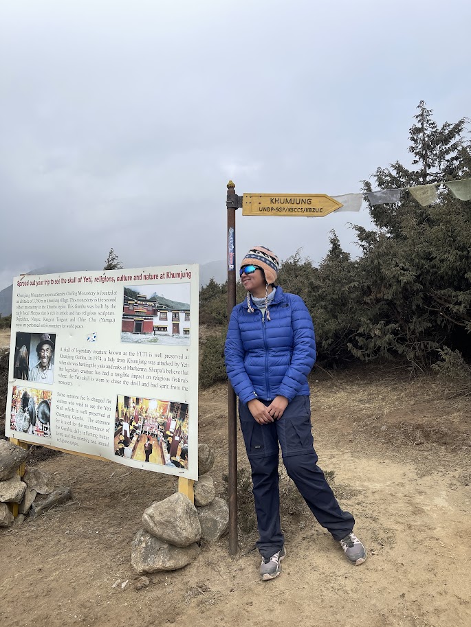
After about an hour of climbing, we reached a signpost pointing toward Khumjung. We took a short break here to catch our breath and enjoy the peaceful surroundings.
Khumjung is a remote village nestled in the Khumbu region, but it’s quite vibrant despite its isolated location. The majority of the population are Sherpas—world-famous for their strength and skill in mountain climbing. The village itself is rich in culture and history. Founded by Sherpas who originally migrated from Tibet, Khumjung has preserved its traditional architecture and strong spiritual roots. Life here is deeply connected to nature and community, and it’s easy to see how much pride the locals take in their heritage.
An hour’s trek further brought us to Syangboche, a scenic village perched at around 3,800 meters (12,467 feet). This spot usually offers breathtaking views of towering peaks like Everest, Lhotse, and Ama Dablam. However, when we arrived, clouds had rolled in, so the views were hidden. Still, it was a lovely place to rest. We stopped by the Sherpa Panorama Hotel café, where we shared an apple pie and had some coffee for 1000NPR or 500PHP. The café also had a restroom outside and offered a reliable Wi-Fi connection, which was a nice surprise at such a high altitude.
The Descent from Khumjung – Easier, But Still Demands Caution
After taking a well-deserved break and enjoying some coffee at the café, we began our descent back down from Khumjung. Compared to the steep climb earlier, the downhill trek felt noticeably easier on the body. However, I still had to watch my step—some parts of the trail were narrow and slippery, and I definitely didn’t want to risk sliding off the mountain.
The gentler terrain allowed me to relax a bit more and really take in the surroundings. I found myself stopping often to snap photos of the stunning landscape. It was one of those rare moments in a trek when you could fully appreciate the beauty without being completely out of breath.
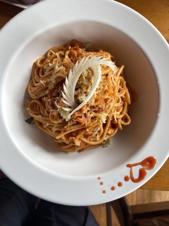
Once we arrived, we just settle in and had our lunch. I had a spaghetti during this time, it was an okay taste and I enjoyed it with my soda.
Everest Bakery
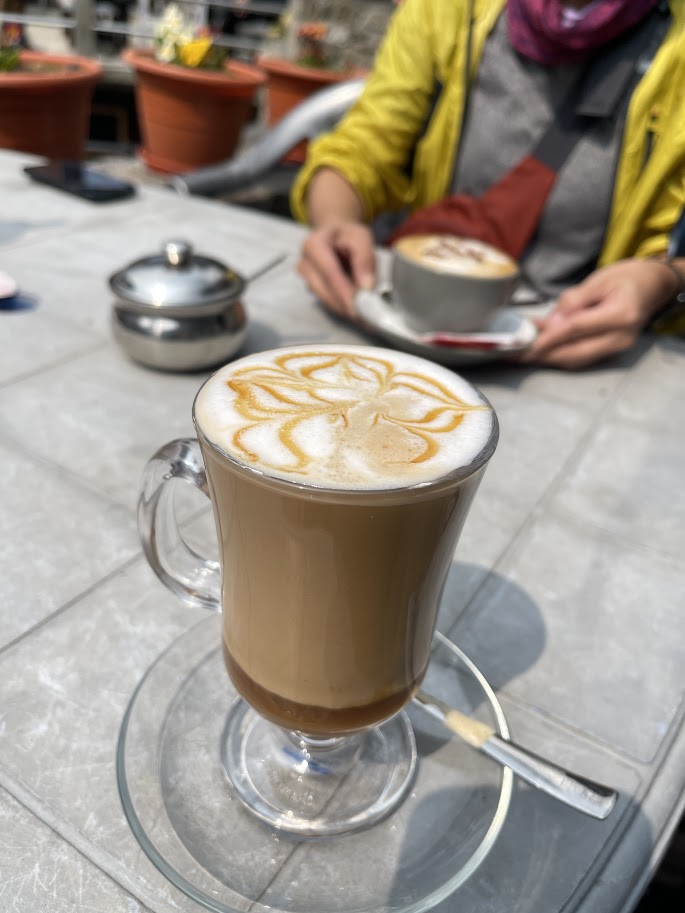
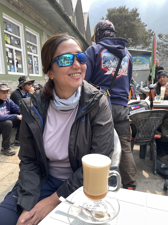
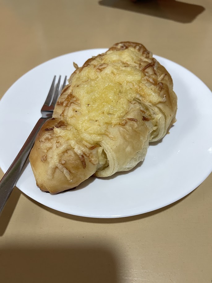
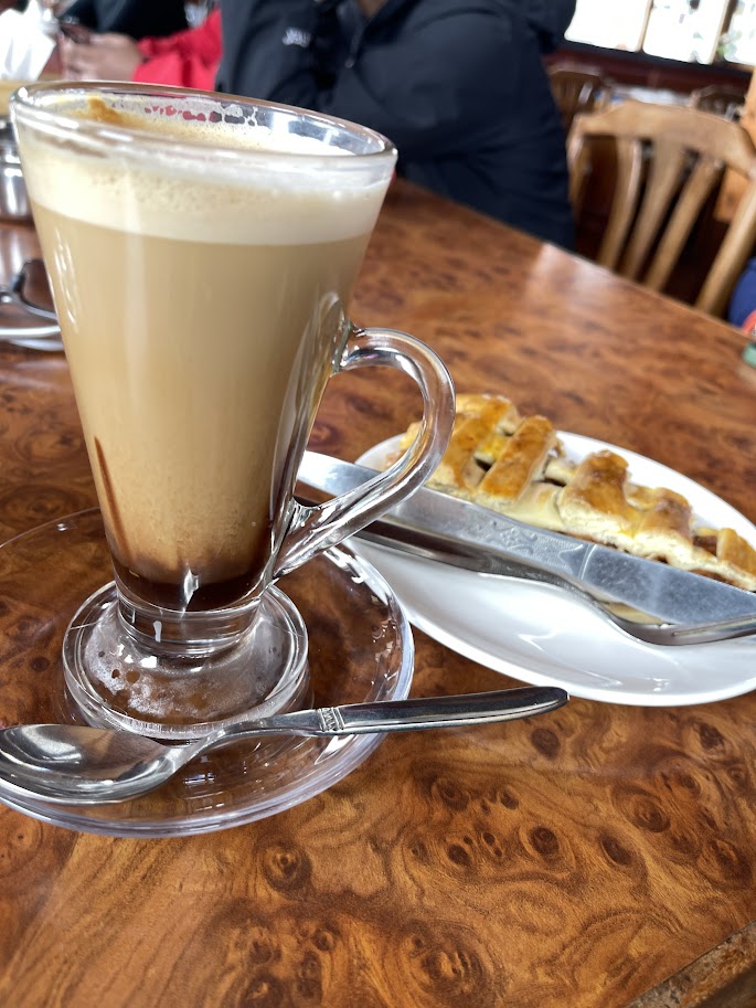
After lunch and a much-needed hot shower, I got ready to explore the charming mountain village of Namche Bazaar. As I stepped outside, a soft drizzle began to fall—typical Himalayan weather adding to the experience. Undeterred, I made my way through the misty streets with my team and found comfort inside the cozy warmth of Everest Bakery.
There, surrounded by my team, we shared stories over buttery cheese croissants and steaming lattes. It was the perfect post-hike indulgence—comfort food for the soul in one of the most surreal places on Earth.
Though this wasn’t a “rest day” in the way I originally imagined, it was essential in helping our bodies adjust to the altitude—and it was filled with beautiful places and moments I’ll never forget. I love Namche Bazaar, I am still awe until today.
After an afternoon of shopping and soaking in the charm of Namche Bazaar, we settled in and began preparing for the next leg of our journey. For dinner, I kept it simple and comforting with a warm bowl of fried noodles with cheese on top—just what I needed before turning in for the night.
As I write this, heartbreaking news has emerged: the first recorded death on Everest this season occurred at Camp IV, and the climber was a fellow Filipino. It’s a sobering reminder of the risks involved in high-altitude expeditions. For those of us who deeply love the mountains and dream of standing at the foot—or the summit—of the Himalayas, this news hits especially hard. My thoughts go out to his family, his team, and to all who venture into the peaks with courage in their hearts. More info here.
Part 3: Itinerary for the Everest Base Camp Trek from Day5-7 here
With love from the Himalayas,
Maria — or as I’m sometimes called, Niskie


Leave a comment